Click here for iFriendly audio.
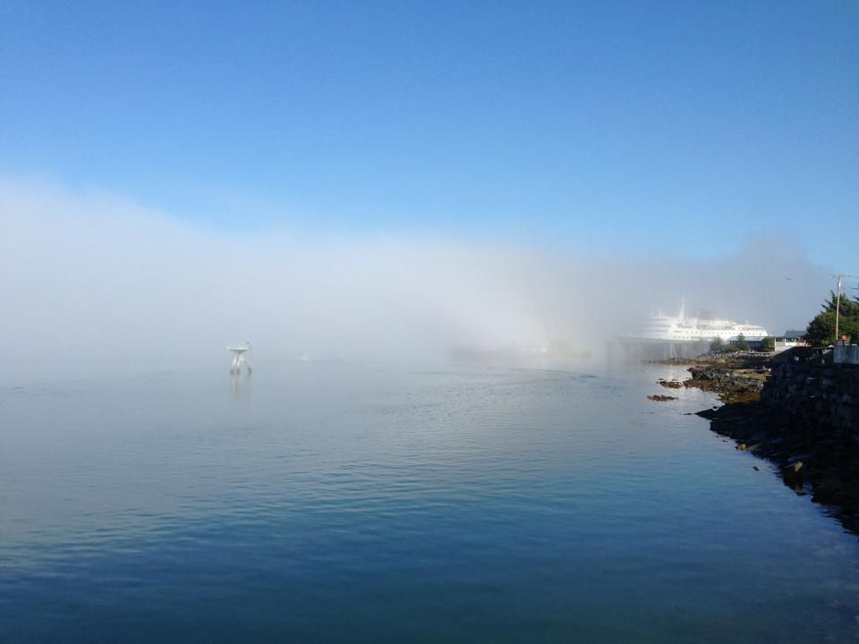
Last week, a dense fog blanketed the waters outside of town every morning.
For the landlubbers out there, it’s not really just a fog, but something called a marine layer.
We can turn to the science of meteorology to find out why this phenomenon was so common this summer.
Bezenek is a lead forecaster with the National Weather Service in Juneau. He says he’s wanted to be a weather forecaster since he was a kid.
“I jokingly tell my sisters that I got my two forecasts right. When I was still going through high school, and even younger—I told my one sister that it was going to hail on her birthday and it did. Then I told my next sister, just after the hail storm, that she was going to get a blizzard on hers and she got the blizzard. I’ve been aiming to be right since then.”
He says that along with being fascinating, it’s an important job.
“It was one of those things that just sort of piqued my interest. It’s a challenge and it is fun. And up here in Alaska, we’ve got a lot of weather-savvy people but they still count on us to tell them when the really dangerous weather conditions are.”
Bezenek says his office is getting a lot of questions about the hot weather we’ve been having in Southeast this summer.
“Over the last 10 or 12 years, there’s only been a couple of years where the summer has been this nice with the warmth and extended dry coming with it.”
He says forecasters are comparing it to the summer of 2004, which had similar conditions.
When Bezenek looks at weather he sees understandable patterns. That’s unlike many of us who just see Xtra-tuf days and bathing suit days.
But this summer even has forecasters doing a bit of a double take.
“I don’t want to necessarily say it’s unusual, but it sort of is, that we’ve had the weather patterns that have persisted for weeks on end.”
Now, to the marine layer. Think about the water of the Inside Passage and the air above it.
A marine layer happens when the warm outer shell of an air mass is cooled by the chilly air coming off the water.
Warm air rises and cold air sinks.
So, the rest of the warm air traps the cooled layer beneath it.
In a nutshell, that’s why marine layers appear thick and stuck on the water.
This process comes down to pressure.
“Generally the larger and the longer areas of high pressure persist across an area, especially out over the Gulf, the more likely it is to build the marine layer. That is either going to force the marine layer in through the Inner Channels and into the Wrangell/Petersburg area, or, if it’s in the right spot, it will actually just form over the Inner Channels and then just spread its way onshore.”
Bezenek says the same conditions that spur the formation of marine layers are also good for making sunny, warm days.
“We’ve had the areas of high pressure anchored over the Eastern gulf. That allows a lot of clear skies, and a weak flow pattern across Southeast Alaska.”
That’s why the marine layers were so common over the water while it was dry and hot on land.
What’s in store for Wrangell? He predicts the hot weather is over and rain and cooler temperatures are here to stay.


